
Example: The Sanborn® Fire Insurance Map of Muncie, Indiana, from 1883 includes numerous blacksmiths, liveries, feed
stores, carriage shops, and
harness and leather shops. Nearly every
dwelling and most businesses also
had a stable at that time. Students of history could research a specific area of
the map on the subsequent
Sanborn maps of Muncie—up to 1911—to analyze the changes in these equine (horse-related) structures and businesses. The
Sanborn maps of Muncie from 1954 available in Archives and Special Collections could be used to
supplement this learning
project.
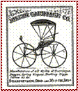
Miller
Carriage Company logo, Map of Delaware County Indiana, Indexed and Printed in
Atlas Form from 1874 Wall
Map, Dolores Rench and Nona Nunnelly,
1989, Geospatial Resources & Map
Collection, University Libraries, Ball State University.